Zoom Earth MOD APK (Pro)
Description
Zoom Earth is a powerful, interactive weather visualization platform that provides a real-time window into the planet’s atmospheric conditions. It functions as both a sophisticated weather map and a high-accuracy tracking suite for natural phenomena like hurricanes, wildfires, and severe storms. By aggregating data from global satellite networks and ground-based Doppler radar, Zoom Earth allows users to explore live weather patterns with stunning clarity. Whether you are a storm chaser, a researcher, or someone simply checking the forecast for a weekend trip, this application turns complex meteorological data into an intuitive, bird’s-eye view of the world.
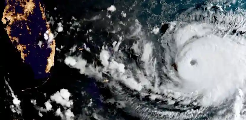
Eye in the Sky: Near Real-Time Satellite Imagery
Zoom Earth sets itself apart by offering near real-time satellite imagery that updates as frequently as every 10 minutes. The app pulls live data from top-tier geostationary satellites, including NOAA GOES (Americas), JMA Himawari (Asia), and EUMETSAT Meteosat (Europe/Africa). For those who require even finer detail, the platform provides HD imagery updated twice daily from NASA’s polar-orbiting satellites, Aqua and Terra. This constant stream of data ensures you are seeing the world exactly as it appears from space, with only a minimal processing delay of 20 to 40 minutes.
Precision Forecasting: Rain Radar and Nowcasting
Stay ahead of localized weather events with the Rain Radar & Nowcast feature. This tool utilizes ground-based Doppler radar to detect precipitation in real-time, displaying rain and snow movements across the map. Beyond just showing what is currently happening, the radar nowcasting system provides instant, short-term forecasts, giving you a precise “heads-up” on exactly when a storm will hit your specific coordinates. This level of immediacy is essential for outdoor safety and event planning.
Advanced Analytics: Comprehensive Global Forecast Maps
The application features stunning, interactive visualizations driven by world-class forecast models like DWD ICON and NOAA GFS. You can toggle between several specialized layers to understand the environment deeply:
- Wind & Gusts: Track average speeds and sudden bursts of wind.
- Temperature & “Feels Like”: View actual air temperatures versus the perceived heat index.
- Wet Bulb Temperature: Monitor areas where high humidity and heat pose a significant risk to human health.
- Atmospheric Pressure: Identify high and low-pressure systems that dictate clear skies or incoming storms.
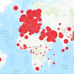
Natural Disaster Monitoring: Hurricane and Wildfire Tracking
Zoom Earth is an industry leader in Tropical Tracking, following hurricanes and cyclones from their initial development to Category 5 intensity. Using data from the NHC and JTWC, the app provides clear, easy-to-understand paths and intensity forecasts. Additionally, the Wildfire Tracking overlay uses NASA FIRMS data to show active heat spots and fire zones. When combined with GeoColor satellite imagery, users can track the movement of wildfire smoke in real-time, providing crucial situational awareness for affected regions.
Tailored to You: Extensive Customization
To ensure the best user experience, Zoom Earth offers a wide range of Customization settings. You can easily adjust units for temperature (°C/°F), wind speed (km/h, mph, knots), and atmospheric pressure. The app also allows you to change time zones, choose between translucent or opaque overlays, and select various animation styles. These features ensure that the data is presented in a way that is most useful for your specific professional or personal needs.
What's new
- Radar Beta: Try our all-new real-time rain radar map, with significantly improved accuracy. Coverage is limited during the beta stage.
- Heat Stress: Found under the temperature section, the new Wet-Bulb Temperature map shows areas where extreme heat and humidity could be dangerous to human health.
Images