Altimetro – Altimeter professional (Paid)

Description
You no longer need to guess your elevation. The Professional Altimeter app detects your altitude automatically and shows the real height of your location. Whether you hike, climb, ski, ride, or travel, this tool gives you fast and reliable elevation data right on your phone. It even keeps working when you have no internet connection.
Why This Altimeter App Stands Out
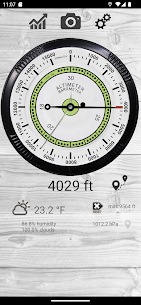
Most altitude apps rely on one method and quit when the signal drops. This professional altimeter combines three smart detection methods. That means you get a more accurate reading in more places. You see your altitude in meters or feet, and the app presents it through a clean analog gauge plus a digital measurement.
How Automatic Altitude Detection Works
The app uses a complex algorithm that blends three sources:
- Satellite triangulation: It calculates your position even without internet access.
- Map altitude: It reads the land elevation at your exact location.
- Pressure sensor: If your phone has one, the app calibrates it with the nearest weather station for better precision.
You can also switch to manual mode. Choose Map Altitude, Flight Altitude, or GPS Altitude whenever you want to fine-tune the result.
Track Your Route, Speed, and Elevation Gain
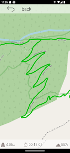
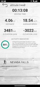
The history feature does more than save a pin. It memorizes your route on the map and builds altitude difference graphs. You get indicators for speed, average speed, and total altitude gain. The best part? It keeps recording even when you close the app, so you can review your full journey later.
Stay Safe with Emergency Alerts
Adventure can turn unexpected. The alert system lets you send your position by message or SMS when you need help. You can share your location quickly, which makes this altimeter app useful for hikers, climbers, and solo travelers.
Check Weather, Temperature, and Humidity
You also get weather forecasts with trend information, temperature, and humidity measurements. That helps you plan your next move, dress for the conditions, and stay aware of changing mountain weather.
Take Photos with Altitude and Location Data
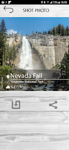
Want proof of your summit? The app lets you take photos and overlays data on the image, including your location and altitude. You can save the moment and share it with friends, family, or your hiking crew.
Add a Custom Widget to Your Home Screen
You can place a custom widget on your home screen. That way, you see important altitude data without opening the app. It keeps the information handy and makes quick checks effortless.
Who Should Use This Professional Altimeter?
This app suits hikers, mountaineers, trail runners, cyclists, skiers, pilots, geologists, and anyone who wants accurate elevation data. If you care about altitude, speed, weather, and safety, this tool puts everything in one place.
Images

What's New
- Improved permission management
- Increased altitude acquisition speed
- Reporting of settings issues with autofix
- Improved route management with real-time map and altitude variation